Lynx Trail - Stage 07 Ennstalerhütte Lodge - Mooslandl


- Multi-day tour
Interactive elevation profile
Create PDF
Tour-Details
Paths covering:
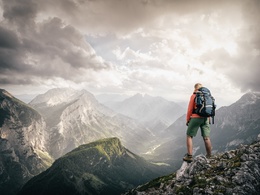
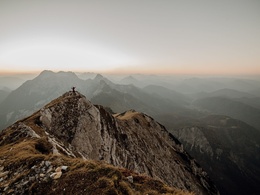
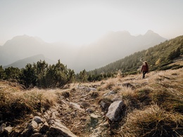
Onward and upward: Traversing the northern Gesäuse mountains via the Ennstalerhütte Lodge
Quality of experience: ******
Recommended season:
- May
- June
- July
- August
- September
- October
Properties:
- Multi-stage route
- Scenic
- Refreshment stops available
Onward and upward: Traversing the northern Gesäuse mountains via the Ennstalerhütte Lodge
Directions:
After a good breakfast at the Ennstalerhütte lodge you return to the Landlereck junction, from where you start on a steep descent towards Bärensattel/Erb/Hackenschmied/Landl. On the Bärensattel pass, the route forks off towards Hackenschmied and Landl (Path No. 646), taking you through an untouched beech forest. When the trail joins a forest road, you follow it until you reach the main road. Turn right in front of a large white house (known as ‘Hackenschmiede’), and look out for a small, wooden signpost towards Landl. You walk up the initially steep gravel road, until the first houses of Landl come into view. Walk past the village church, leave the butcher’s shop (‘Fleischerei Pfeiler’) to your right, and then turn right into ‘Hartlstraße’ Road, which you follow all the way to the Eisen main road. After around 500 m, you get to a bus stop, where you cross the main road and follow the sign for ‘Hauptkraftwerk Landl’. This road will take you downhill, across the Enns Bridge, and finally – having crossed over the railway tracks – uphill again. At the first right-hand bend, you keep right and follow the L744 road for around one kilometre, until you have reached the village of Mooslandl. Turn right onto the main street, and you will see the Mooswirt Inn – your destination for the day.
Tip:
We recommend that you make contact with the Lynx Trail Info & Booking Centre before making a booking.
Safety guidelines:
Mountain Rescue 140
Equipment:
Sturdy mountain walking boots or trail shoes, as well as a rucksack packed with essentials (water bottle, plasters for blisters, trail map, food etc.). You should also be well prepared for changes in the weather. If you are staying overnight in mountain huts don’t forget your sleeping bag!
Additional information:
Hints and tips
Lynx Trail Info & Booking Centre
Trail Angels GmbH
Obervellach 15, 9821 Obervellach
Tel.: +43 47 82 93 093
Web: https://www.bookyourtrail.com/trail/luchs-trail
Email: info@bookyourtrail.com
Lower Austria Information Office:
Mostviertel Tourismus GmbH
Töpperschloss Neubruck
Neubruck 2/10, 3283 Scheibbs
Tel.: +43 (0) 7482 204 44
Email: info@mostviertel.at
Upper Austria Information Office:
Tourismusverband Nationalpark Region Ennstal
Eisenstraße 75, 4462 Reichraming
Tel.: +43 (0) 7254 8414
Email: info@nationalparkregion.com
Steiermark Information Office:
Tourismusverband Gesäuse
Hauptstraße 35, 8911 Admont
Tel. +43 (0) 3613 21160 10
Email: info@gesaeuse.at
further information:
- Multi-day tour
- Board possible


Getting there
Public Transit
In the Gesäuse you are mobile even without your own carOne call to t: +43 3613 21 000 99 is enough: During operating times, you can take the Gesäuse Sammeltaxi to any destination in the Gesäuse, without any timetable or stops.
Further information & operating times
Timetable inquiry at www.oebb.at or www.busbahnbim.at
Parking
Parking facilities are available at the respective starting points, which are subject to a charge, especially in the Gesäuse National Park area.
Tip: Please leave a note in your car with your telephone number and the date of your return, together with a note that you are on a hike lasting several days. The mountain rescue service will thank you!
- Spring
- Summer
- Autumn
Please get in touch for more information.
Interactive elevation profile
Create PDF
Tour-Details
Paths covering:
