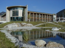
Mollner sunny side round


- Flatly
Interactive elevation profile
Create PDF
Tour-Details
Path number: 2 und 5, 6
Starting place: 4591 Molln
Destination: 4591 Molln
duration: 2h 33m
length: 9,8 km
Altitude difference (uphill): 104m
Altitude difference (downhill): 104m
Lowest point: 388m
Highest point: 475m
difficulty: easy
condition: easy
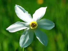
panoramic view: Some Views
Paths covering:
Asphalt, Street
powered by TOURDATA
Short description:
In a leisurely up and down walk to the most beautiful view of the mountains.
In a leisurely up and down walk to the most beautiful view of the mountains.
Quality of experience: ***
Recommended season:
- March
- April
- May
- June
- July
- August
- September
- October
- November
- December
Properties:
- Loop
- Scenic
- Refreshment stops available
From the National Park Center Molln, the path leads past the Gothic parish church of Molln to the district of Gstadt (path no.2.6). On the sunny side - as the name suggests - they walk on sunny paths (No. 2.5) past the Pranzlgraben to the Steiner Kraml inn, where they can take a short break in the chestnut guest garden. The way back starts on the Breitenauer Straße and leads through the villages Rabach and Au back to the starting point.
Trail number: 2, 5, 6
Directions:
From the National Park Center Molln, the path leads past the Gothic parish church of Molln to the district of Gstadt (path no.2.6). On the sunny side - as the name suggests - they walk on sunny paths (No. 2.5) past the Pranzlgraben to the Steiner Kraml inn, where they can take a short break in the chestnut guest garden. The way back starts on the Breitenauer Straße and leads through the villages Rabach and Au back to the starting point.
Starting point: Molln/center of the village
Destination: Molln/center of the village
further information:
- Flatly
- Board possible

Cafe Konditorei Lebzelterei Illecker

Gasthof Steinbichler

Landgasthof Klausner
Accessibility / arrival
Public Transit
The Steyrtal is served by bus lines 452 (Rohr-Bad Hall-Steinbach a. d. Steyr) and 433 (Steyr-Molln-Kirchdorf).
Parking
Molln/parking next to the center of the village
Getting there
From the west: A1 exit Sattledt > via Kremsmünster > Bad Hall > Steinbach an der Steyr
From the east: A1 exit Haag > Steyr > B140 into the Steyr valley
From the north: A3 Passau > Wels > A9 exit Sattledt > Kremsmünster > Bad Hall > Steinbach
From the south: A9 exit Klaus > into the Steyr valley
Public Transit
The Steyrtal is served by bus lines 452 (Rohr-Bad Hall-Steinbach a. d. Steyr) and 433 (Steyr-Molln-Kirchdorf).
Details at www.ooevv.at
With the Steyrtal Museum Railway www.steyrtalbahn.at
Parking
Molln/parking next to the center of the village
Most economical season
- Spring
- Summer
- Autumn
- Early winter
- Deep winter
Please get in touch for more information.
Stadtplatz 27
4400 Steyr
Phone +43 7252 53229 - 0
E-Mail reichraming@steyr-nationalpark.at
Web www.steyr-nationalpark.at/
https://www.steyr-nationalpark.at/
Interactive elevation profile
Create PDF
Tour-Details
Path number: 2 und 5, 6
Starting place: 4591 Molln
Destination: 4591 Molln
duration: 2h 33m
length: 9,8 km
Altitude difference (uphill): 104m
Altitude difference (downhill): 104m
Lowest point: 388m
Highest point: 475m
difficulty: easy
condition: easy
panoramic view: Some Views
Paths covering:
Asphalt, Street
powered by TOURDATA
