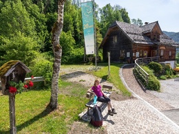
Talblick


- Flatly
Interactive elevation profile
Create PDF
Tour-Details
duration: 3h 19m
length: 10,9 km
Altitude difference (uphill): 406m
Altitude difference (downhill): 409m
Lowest point: 515m
Highest point: 832m
difficulty: medium
condition: difficult
panoramic view: Some Views
Paths covering:
Asphalt, Gravel, Street, Hiking trail, Other
powered by TOURDATA
Short description:
Hiking round from Dörfl Unterlaussa
Hiking round from Dörfl Unterlaussa
Quality of experience: ***
Recommended season:
- April
- May
- June
- July
- August
- September
- October
Properties:
- Loop
- Geological highlights
- Botanical highlights
The hiking tour leads in the direction of Mooshöhe, over the Langseite and the Bodenbach to the Waldbauer and back to the Dörfl.
Directions:
From the idyllic Dörfl Unterlaussa you first hike in the direction of Mooshöhe, leave the asphalt road at a bend on the right and follow the Talblickstraße on the long side and along the Bodenbach down to the Waldbauer. The way back to Dörfl leads along the Sonnleitenweg.
Accessibility / arrival
Public Transit
The Ennstalbahn runs between Linz and Weißenbach-St. Gallen.
Parking
Weyer/Unterlaussa - parking in the Dörfl
Getting there
From Salzburg/Linz: A1 motorway exit Enns-Steyr > B115 into the Enns Valley
From Vienna: A1 motorway exit Haag > B42 > B122 > B115 into the Enns Valley
From Passau: A8 Passau > Wels > A1 motorway exit Enns-Steyr > B115 into the Enns Valley
From Graz: A9 Pyhrnautobahn > motorway exit Klaus > Grünburg > into the Ennstal Valley
Public Transit
The Ennstalbahn runs between Linz and Weißenbach-St. Gallen.
Details at www.ooevv.at
Railway Stations are located in Steyr, Garsten, Lahrndorf, Dürnbach, Ternberg, Trattenbach, Losenstein, Reichraming, Großraming, Gaflenz, Weyer, Küpfern, Kastenreith, Kleinreifling and Weißenbach-St. Gallen.
Parking
Weyer/Unterlaussa - parking in the Dörfl
Most economical season
- Spring
- Summer
- Autumn
Please get in touch for more information.
Stadtplatz 27
4400 Steyr
Phone +43 7252 53229 - 0
E-Mail info@steyr-nationalpark.at
Web www.steyr-nationalpark.at/
https://www.steyr-nationalpark.at/
Interactive elevation profile
Create PDF
Tour-Details
duration: 3h 19m
length: 10,9 km
Altitude difference (uphill): 406m
Altitude difference (downhill): 409m
Lowest point: 515m
Highest point: 832m
difficulty: medium
condition: difficult
panoramic view: Some Views
Paths covering:
Asphalt, Gravel, Street, Hiking trail, Other
powered by TOURDATA
