Around the Hohe Dirn


- Possible accommodation
Interactive elevation profile
Create PDF
Tour-Details
Starting place: 4591 Molln
Destination: 4591 Molln
duration: 8h 45m
length: 68,1 km
Altitude difference (uphill): 1.385m
Altitude difference (downhill): 1.385m
Lowest point: 334m
Highest point: 1.027m
difficulty: medium
condition: medium
panoramic view: Some Views
Paths covering:
Asphalt, Path / trail, Gravel, Hiking trail, Other
powered by TOURDATA
Short description:
Sunny bike tour to a lookout pulpit above the Enns valley with a view over the Wendbach, to the Enns and the alpine foothills.
Sunny bike tour to a lookout pulpit above the Enns valley with a view over the Wendbach, to the Enns and the alpine foothills.
Recommended season:
- April
- May
- June
- July
- August
- September
- October
Properties:
- Round trip
- Scenic
This very sunny mountain bike tour leads to the summit of the Hohe Dirn and to the managed Anton Schosser Hütte.
Directions:
This very sunny mountain bike tour leads to the summit of the Hohe Dirn and to the managed Anton Schosser Hütte. You start at the National Park Center in Molln and cycle on the road towards Breitenau. Passing the Steiner Kraml and Windhager Kores inns, you reach the fork in the Hausbach. There you leave the Breitenauerstraße and turn left into the Hausbach. You reach a forest road junction and follow the mountain bike sign to the left in the direction of Mösern, Hohe Dirn, Wendbach.
At the beginning you cycle along meadows where rare orchids bloom in spring. This is followed by a short, steeper climb through the forest, which then leads more leisurely up to the large forest road junction in the Mösern. There they follow the bike sign Hohe Dirn, which they reach after several easy ascents and descents
Route: National Park Center Molln - Hausbach - Mösern - Hohe Dirn - same route back.
Safety guidelines:
Check in advance for any trail or road closures at www.steyr-nationalpark.at
Equipment:
Remember to pack sun and rain protection.
Additional information:
You can obtain up-to-date map material at: www.steyr-nationalpark.at
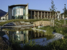
Starting point: Nationalpark Zentrum Molln
Destination: Nationalpark Zentrum Molln
further information:
- Possible accommodation
details mountainbike
- Riding technique: difficult
- Suitable for single travelers
- Suitable for friends
- Suitable for couples
- Spring
- Summer
- Autumn
Please get in touch for more information.
Stadtplatz 27
4400 Steyr
Phone +43 7252 53229 - 0
E-Mail reichraming@steyr-nationalpark.at
Web www.steyr-nationalpark.at/
https://www.steyr-nationalpark.at/
Interactive elevation profile
Create PDF
Tour-Details
Starting place: 4591 Molln
Destination: 4591 Molln
duration: 8h 45m
length: 68,1 km
Altitude difference (uphill): 1.385m
Altitude difference (downhill): 1.385m
Lowest point: 334m
Highest point: 1.027m
difficulty: medium
condition: medium
panoramic view: Some Views
Paths covering:
Asphalt, Path / trail, Gravel, Hiking trail, Other
powered by TOURDATA
