natur.BANK.wege | Reichraming | Bergerwieshütte | 446205


- Suitable for families
- culturally interesting
Interactive elevation profile
Create PDF
Tour-Details
Starting place: 4462 Reichraming
Destination: 4462 Reichraming
duration: 0h 33m
length: 1,9 km
Altitude difference (uphill): 49m
Altitude difference (downhill): 6m
Lowest point: 380m
Highest point: 428m
difficulty: easy
condition: easy
panoramic view: Dreamtour
Paths covering:
Asphalt, Gravel
powered by TOURDATA
Short description:
In the heart of the Reichraminger Hintergebirge mountains
In the heart of the Reichraminger Hintergebirge mountains
Quality of experience: *****
Recommended season:
- January
- February
- March
- April
- May
- June
- July
- August
- September
- October
- November
- December
Properties:
- Round trip
- Refreshment stops available
- Family friendly
- Cultural/historical value
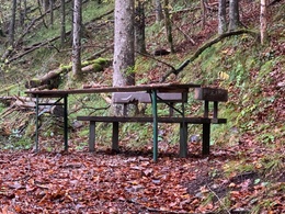
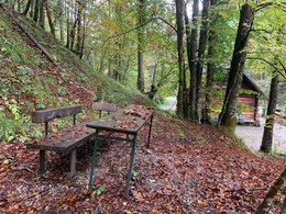
Beautiful hike into the rustic Weißenbach Valley
Directions:
The trail from the Weißenbach car park with only slight inclines to the Weißenbach Chapel. Then turn left into the Weißenbach valley itself.
Tip:
The magnificent winter landscape of the Kalkalpen National Park can also be enjoyed in the Weißenbach Valley in winter. A horse-drawn sleigh takes us along the Weißenbach to the "Bergwiesenhütte". There, mulled cider, farmer's doughnuts and, on request, a hearty farmer's snack and Holzknechtnocken await you.Information about the carriage ride is available from the Schwarzlmüller family.
Additional information:
Starting point: Car park Weißenbach
Destination: natur.Bank.wege Bergerwieshütte
further information:
- Board possible
Accessibility / arrival
Parking
Car park Weißenbach
Getting there
Arrival by train:
The Ennstalbahn runs between Linz and Weißenbach-St. Gallen.
Arrival by car:
From Salzburg/Linz: A1 motorway exit Enns-Steyr > B115 into the Enns Valley.
From Vienna: A1 motorway exit Haag > B42 > B122 > B115 into the Enns Valley
From Passau: A8 Passau > Wels > A1 motorway exit Enns-Steyr > B115 into the Enns Valley
From Graz: A9 Pyhrnautobahn > motorway exit Klaus > Grünburg > into the Ennstal valley
Parking
Car park Weißenbach
Most economical season
- Spring
- Summer
- Autumn
- Early winter
- Deep winter
Please get in touch for more information.
Stadtplatz 27
4400 Steyr
Phone +43 7252 53229 - 0
E-Mail info@steyr-nationalpark.at
Web www.steyr-nationalpark.at/
https://www.steyr-nationalpark.at/
Interactive elevation profile
Create PDF
Tour-Details
Starting place: 4462 Reichraming
Destination: 4462 Reichraming
duration: 0h 33m
length: 1,9 km
Altitude difference (uphill): 49m
Altitude difference (downhill): 6m
Lowest point: 380m
Highest point: 428m
difficulty: easy
condition: easy
panoramic view: Dreamtour
Paths covering:
Asphalt, Gravel
powered by TOURDATA
